Was Weaponized GIS Used in Lahaina?
Click-and-destroy program for “sustainable redevelopment”
by Sasha Latypova, Due Diligence & Art
August 28, 2023
This information is from an anonymous contributor. It describes the evidence from the GIS (Geographic Information System) of extreme precision and selectivity of the Lahaina fire. It also points to the plans of potentially moving all low-income residents off their properties and into a concentration camp, ahem, a 15-minute city.
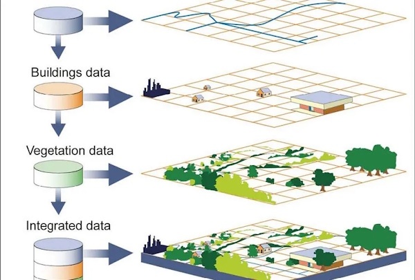
GIS system is a computer system for capturing, storing, checking, and displaying data related to positions on Earth’s surface. GIS can show many different kinds of data on one map, such as streets, buildings, and vegetation. This enables people to more easily see, analyze, and understand patterns and relationships. US Government has all these data layers in extreme detail for all developed areas in the country.
As of today (Aug 25, 2023) if you navigate your web browser to Google Maps, select “satellite view”, then select “globe view”. It appears that the aerial imagery was recently updated to reflect the damage from the recent “event”, that took place in Lahaina Hawaii earlier this August. Out of curiosity I also looked at GIS information on Lahaina, (link below) and wanted to see if there is correlation between damaged structures and particular zoning. I found some interesting things here.
GISLink: https://qpublic.schneidercorp.com/Application.aspx
Starting at the North end of Lahaina, I see the Fire Station, Courthouse, Civic center, Police Station where all spared from fire damage despite very clear fire damage to surrounding undeveloped land around these buildings.
What I found interesting is the surrounding undeveloped land with extensive fire damage, are parcels owned by “Department of Hawaiian Homelands”, “Housing Finance and Dev Corp”, which both appear to be the same and fall under Hawaii’s HUD authority. HUD appears own property running south from the civic center down to the Lahaina Bypass.
Everything west of HUD owned parcels are hundreds of small residential lots which where all destroyed seemingly from fires on originating from that HUD land.
Only a small home community was spared and appears intact between Leiali Pkwy and Kaniau Road. Interesting thing about this community is it appears to fall
Under HUD authority as well!
Large inland parcels south of the Lahaina Bypass are owned by large developers and trusts, and everything west of these parcels were hundreds of small residential lots which were all destroyed as well.
What’s most interesting about looking at the aerial imagery, is that amongst the destruction are various structures still standing with green grass & green trees, nearly right up to edge or property line. Looking at GIS data & street view some don’t make sense, as a few have all wood construction! In other cases, condo complexes that appear to be of concrete construction, completely destroyed.
The large commercial area in the center of Lahaina appears to be untouched, the schools on eastern end of Lahaina also appear untouched. This could also very well be due to the construction of these buildings.
A standout of precise destruction is a cluster of what appear to be recently constructed townhomes and condominiums, called “Kahoma Village”. The entire community appears intact, intact homes, green grass. Yet four of the buildings in the center completely destroyed, with cars in the adjacent parking areas looking untouched.
Overall if you’re in a residential zone, commercial mixed use, industrial, hotel zone, damage or destruction is heavy. It appears the government is assigning a “Destroyed 823” code to a lot of these parcels as well.
I can’t help but notice the destruction of buildings is almost following the property lines, even extents of building exteriors. It would be akin to clicking a parcel or structure in GIS and selecting the “terminate” option.
I was looking at this more last night and discovered some drone footage uploaded earlier this week. 18 min of drone footage taken the day after:
Footage is mainly the southern end of Lahaina:
-At 2:05 you can see the Komoha Village I referenced. 4 buildings burned to the ground, yet no evidence of surrounding damage to remaining buildings fully intact. Buildings to the right don’t even have soot on the roof or burned shingles! I’m guessing this complex was being built sometime after March 2020 based on parcel data.
-At 2:18 he flies drone south over front street apartments, according to GIS these are low-income homes completely destroyed.
-At 2:32 he’s flying east, structure on the left in foreground was formally a 4-story condo complex. On the top left of the screen on background you see new homes being constructed, this is on HUD owned land according to parcel map.
-At 4:42 he’s now flying south; you see the fully intact Lahaina Shores beach resort. Directly north to this resort was formally a bunch of small businesses in two story structures you can see on street view. Appears the only thing remaining is the elevator shaft. What’s interesting about this is according to GIS, Lahaina Shores also owned this but had their parcel subdivided into hotel & historic. The structure sat on historic, yet the hotel is fine. Still, I see no smoke damage, heat damage, nor soot on the hotel.
I was looking more at GIS map as well. Looks like there is a right of way cutout for the Lahaina bypass to continue north at some point. In addition, the road adjacent to the gov building is called Lelali Pkwy and looks designed to handle high traffic. If I continue on GIS map north into Kaanapali, parcels owned by private developers appear the have a right of way for a roadway that could connected to Lahaina bypass.
What’s unique about this is the infrastructure of this town is intact. The gov buildings are fine, all roadways are fine and usable. Bridges are intact. The water treatment plant on top of the hill adjacent to school (east end of Lahaina) is fine. School is intact. The substation and solar farm next to school are intact. The commercial area and new low-income homes being built off Lahaina bypass are fine. Wastewater treatment plant appears to be north of Lahaina in Kaanapali is intact. Essentially, it’s a turnkey community ready to be “redeveloped”. I call it weaponized GIS, because to me it looks like parcels and buildings were clicked and destroyed in a GUI program (much like they would be in my CAD programs).
My 2 cents: government signs emergency order to rezone the agri land owned by HUD on northeast end of Lahaina, all the displaced indigenous and low-income residents are put there. The is all expediated due to urgent need for homes. All the land west of them adjacent to the water is redeveloped into condos to pay for the project. Residents are hit with some kind of “hazardous environment fee” to financially prevent them from rebuilding their property. The other partially destroyed condo complexes file massive insurance claims for damaged buildings. New structures will also have to conform to some kind of environmental sustainability regulations which will also be cost prohibitive to low-income native residents. Aside from the water, the community has two main points to enter and exit, residents have their very own new 15-minute city.
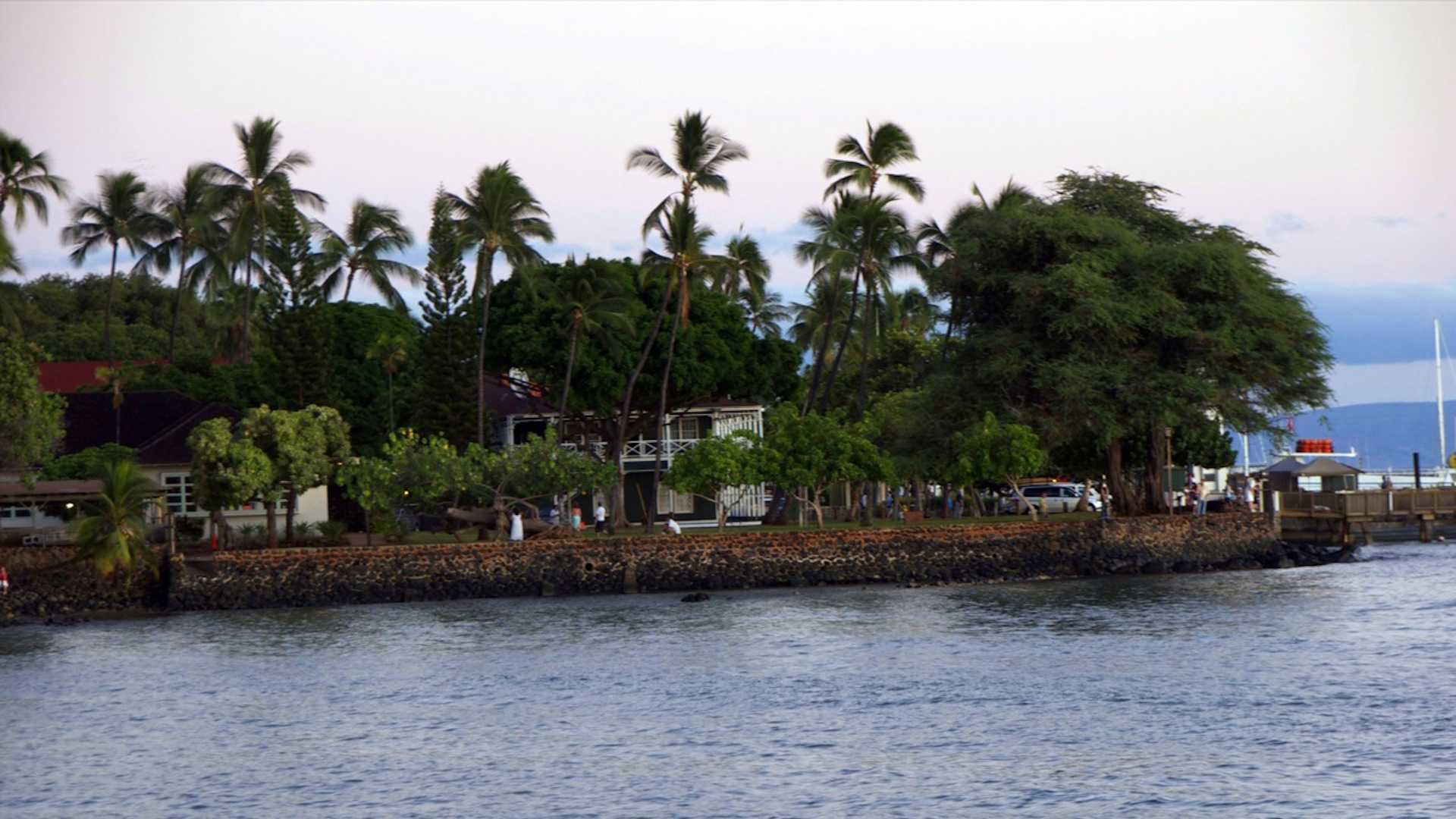
Cover image credit: happyskrappy


Truth Comes to Light highlights writers and video creators who ask the difficult questions while sharing their unique insights and visions.
Everything posted on this site is done in the spirit of conversation. Please do your own research and trust yourself when reading and giving consideration to anything that appears here or anywhere else.